

Book Tickets Online
About
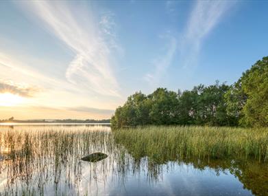
Moor Lough is an upland lake of approximately 16.2 hectares located in the Sperrin Area of Outstanding Natural Beauty .It sits at an altitude of some 170 metres and within two parishes - Donagheady and Leckpatrick. Owenreagh Hill is located on the higher ground to the south west and Balix Hill lies to the south east.
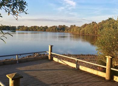
The lough is part of the public angling estate operated by DAERA’s Inland Fisheries and provides excellent fishing for trout. A gravel track which circumnavigates the lough makes most of the shoreline accessible for all. The track is approximately 2km / 1.2 miles in length and provides a scenic short walk option for locals and visitors alike.
Moor Lough is believed to have been formed at the close of the last Ice Age between seventeen to thirteen thousand years ago. During this period the massive ice sheets that covered most of Northern Europe were melting due to climatic change. Moor Lough is considered to be a kettle hole lake - a large depression that was left in the landscape after a great block of ice was covered by meltwater sediments flowing from a nearby ice sheet. The block of ice melted as the climate got warmer, leaving a hollow in the landscape that eventually filled with water to form Moor Lough. The hummocky landscapes that are found just to the north of Moor Lough are also features that were formed at the close of the last Ice Age. The hummocks and most of the land surrounding Moor Lough are now covered in peat bog that has developed since the Bronze Age as Ireland’s upland weather changed and became much wetter.
In more recent years Moor Lough and its surrounding landscape has taken on a significance of its very own by becoming the subject of the popular Irish folk song ‘The Moorlough Shore’. The song first appeared as a printed song sheet in the 1880s however there has been much debate about exactly which Moorlough in Ireland the song celebrates. This location has a strong case to support its claim to being the inspiration for the song. The lyrics include a reference to ‘Sinclair’s Castle grand’ and not far from this lake’s shores once stood an estate owned by the Sinclair Family. Linen and bleaching are also referred to in the song. Again the Sinclair Estate is known to have included a flax mill and linen bleach greens.
Follow the A5 Strabane Londonderry Road north from Strabane and turn right onto the B49 Woodend Road, Artigarvan and Donemana are signposted this way. In Artigarvan, turn right onto the Moorlough Road. Continue along this road passing through the sall village of Glenmornan. Continue along this road then turn right onto the Napple Road. After 500m turn left . This road which will lead you to the parking area at Moor Lough.
Northern Ireland - Google Maps
For additional information on angling at Moorlough click on the following link Angling at Moor Lough | nidirect


